Cartography & the North in Early Modern Japan
In the Tokugawa period (1615–1868), maps were not only a tool for travel or locating specific geographic sites but also a tool of administration, political authority, propaganda, and the imagination of a territory for religious or literary purposes. After the Tokugawa shogunate was established, the government began compiling provincial maps called kokugunzu 国郡図, taking stock of domains and their administration.1Kazutaka Unno, “Cartography in Japan,” in Cartography in the Traditional East and Southeast Asian Societies, vol. 2 of The History of Cartography, J.B. Harley and David Woodward, eds. (Chicago: University of Chicago Press, 1994), 346. These efforts are important for thinking about the North, a region that had existed on the peripheries of the state and ambiguously unincorporated into full Japanese oversight for centuries, because Ezo 蝦夷 (Hokkaido), Karafuto 樺太 (Sakhalin), and Chishima 千島 (Kuril Islands) became more visible through the Japanese systems of naming, measuring, and classifying. In this sense, maps helped turn the North from a distant and uncertain region into a territory that could be understood through (and absorbed into) Japanese political and geographic views.
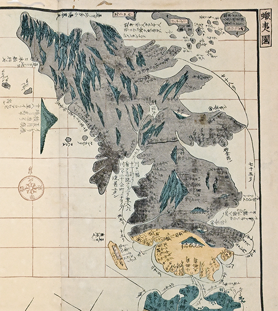
The North was also an indigenous space. In his extensive study of Japanese cartographic practices, Unno Kazutaka notes that Ezo was divided into several areas. For example, Matsumae 松前 and Ezochi 蝦夷地 (“ezo” meaning “barbarian” and “chi” meaning “land”); Kita 北 or Oku 奥 (meaning “north” or “distant,” in reference to Sakhalin), and Ezo ga Chishima 蝦夷千島 or Chishima in reference to the Kuriles (Fig. 1).2Unno, 443. These names, rooted in labels that situated these areas as part of “barbarian” lands and distances from the main islands, show that Japanese maps described the North through Japanese political and geographic knowledge that centered their own experiences. But at the same time, these places are also Ainu homelands, trade zones, and cultural spaces. When maps label these places through Japanese terms, then and now, it can render the Ainu presence less visible. In early modern (and indeed, much of modern cartography), these lands have appeared as a frontier of Japan, rather than a place that is shaped by and central to Ainu culture, movement, and history.
From the late eighteenth and early nineteenth centuries, the Tokugawa shogunate put more focus on mapping the north. Surveyors and explorers such as Mogami Tokunai (1754–1836), Kondo Morishige (1771–1829), and Mamiya Rinzō (1780–1844), who spent extended periods of time traveling the North, improved Japanese knowledge of Hokkaido, Sakhalin, and nearby islands.3Unno, 440, 447. These maps helped officials in Edo see distant, northern places as knowable and governable. However, these expeditions and the intrusion of Japanese colonizers into these lands brought with it exploitation, commercial and geographic displacement, and political dominance that caused great destruction and suffering to Ainu communities.
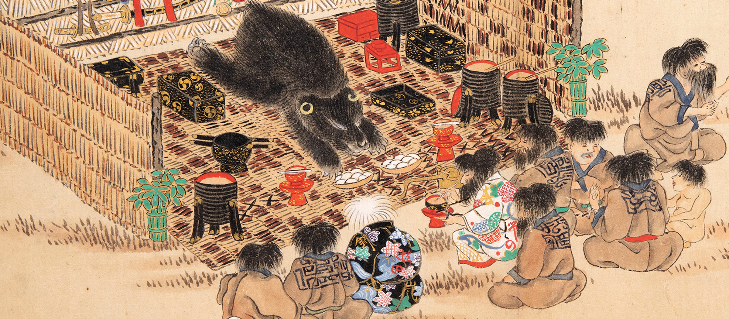
The influence of these early modern legacies, and the carelessness with which Ainu were treated, can still be felt; Ainu culture has often been treated as something “useless,” or as a culture of the past, even though Ainu communities are still alive and active in contemporary Japan. Ainu were exoticized and even exhibited at international exhibitions at the end of the nineteenth century, with many Japanese museums using Ainu people, objects, and people as objects to present an image of an archaic, “traditional” Ainu culture, while thinking little of Ainu lived histories and current experiences.4Naohiro Nakamura, “The Representation of Ainu Culture in the Japanese Museum System,” The Canadian Journal of Native Studies 2 (2007), 339–340; 359–360. In this way, both maps and museums have in various ways turned Ainu culture into a “knowledge” to be studied by others. In early modern maps, Ainu land became a northern frontier, while in museums, Ainu’s objects, or even bodies, became spectacles. In both cases, Japanese perspectives shaped how people viewed Ainu, placing them in Japanese terms and frameworks of understanding.
Examining maps of Japan’s early modern world like those in the UCLA collections, where we, too, become viewers, requires us to think about more than simply what the map shows. Who made the map? Who used it? What names appear within and what names disappear with time? As the maps you will see on this site show, for centuries the North was mapped, collected, and displayed by Japanese artists and surveyors, but Ainu people’s voices were rarely a part of that process.
References
Aida Nobuyuki 会田信行. “Nihon no kurinomētā no rekishi 日本のクリノメーターの歴史.” Chirigaku kyōiku to kagaku undō 地学教育と科学運動 83 (2019): 51–55.
Nakamura, Naohiro. “The Representation of Ainu Culture in the Japanese Museum System.” The Canadian Journal of Native Studies 2 (2007): 331–365.
Unno, Kazutaka. “Cartography in Japan.” In Cartography in the Traditional East and Southeast Asian Societies, vol. 2 of The History of Cartography, edited by J.B. Harley and David Woodward, 346–477. Chicago: University of Chicago Press, 1994.