Complete Map of Ezo's Borders
Ezo kōkyō yochi zenzu 蝦夷闔境輿地全圖
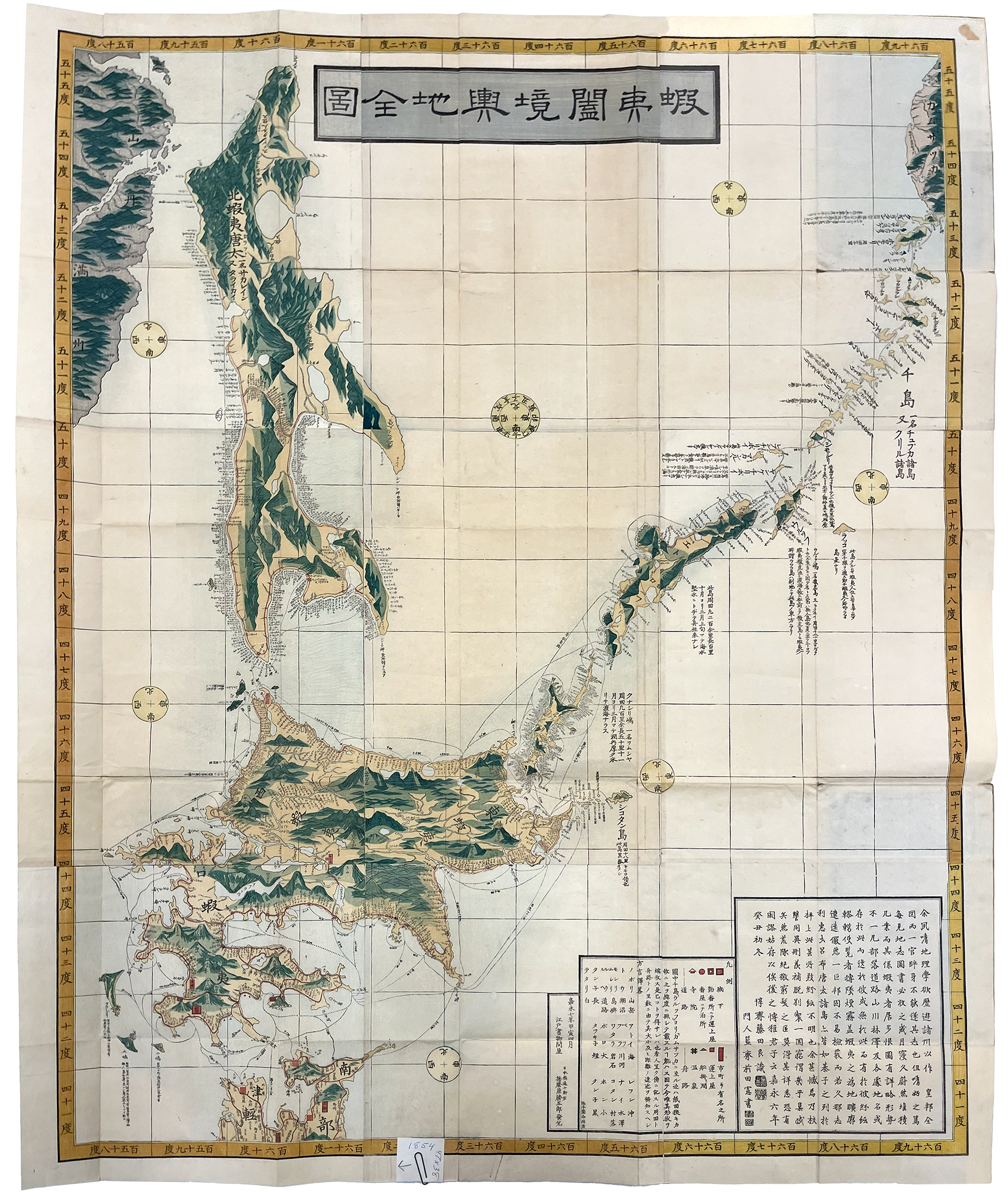
The Complete Map of Ezo's Borders (Ezo kōkyō yochi zenzu 蝦夷闔境輿地全圖) was created in Kaei 嘉永 7 [1854] and is color printed on paper, measuring 96.6 cm × 120 cm (unfolded). The map lists Fujita Junsai Ryō 藤田惇斎良 as its author and Harimaya Katsugorō 播磨屋勝五郎 as its publisher. With growing interest in and concern about Russia’s presence to the north, this map shows significant interest in Sakhalin and the Kuril Islands. It also displays a better understanding of the shape of Ezo (not yet formally annexed and renamed Hokkaido), knowledge gained from various mid- to late-eighteenth century expeditions. Nevertheless, Hokkaido does appear somewhat vertically compressed in favor of displaying the islands to the north.