Complete Map of Counties in Mutsu and Dewa
Mutsu Dewa kokugun kōtei zenzu 陸奥出羽国郡行程全図
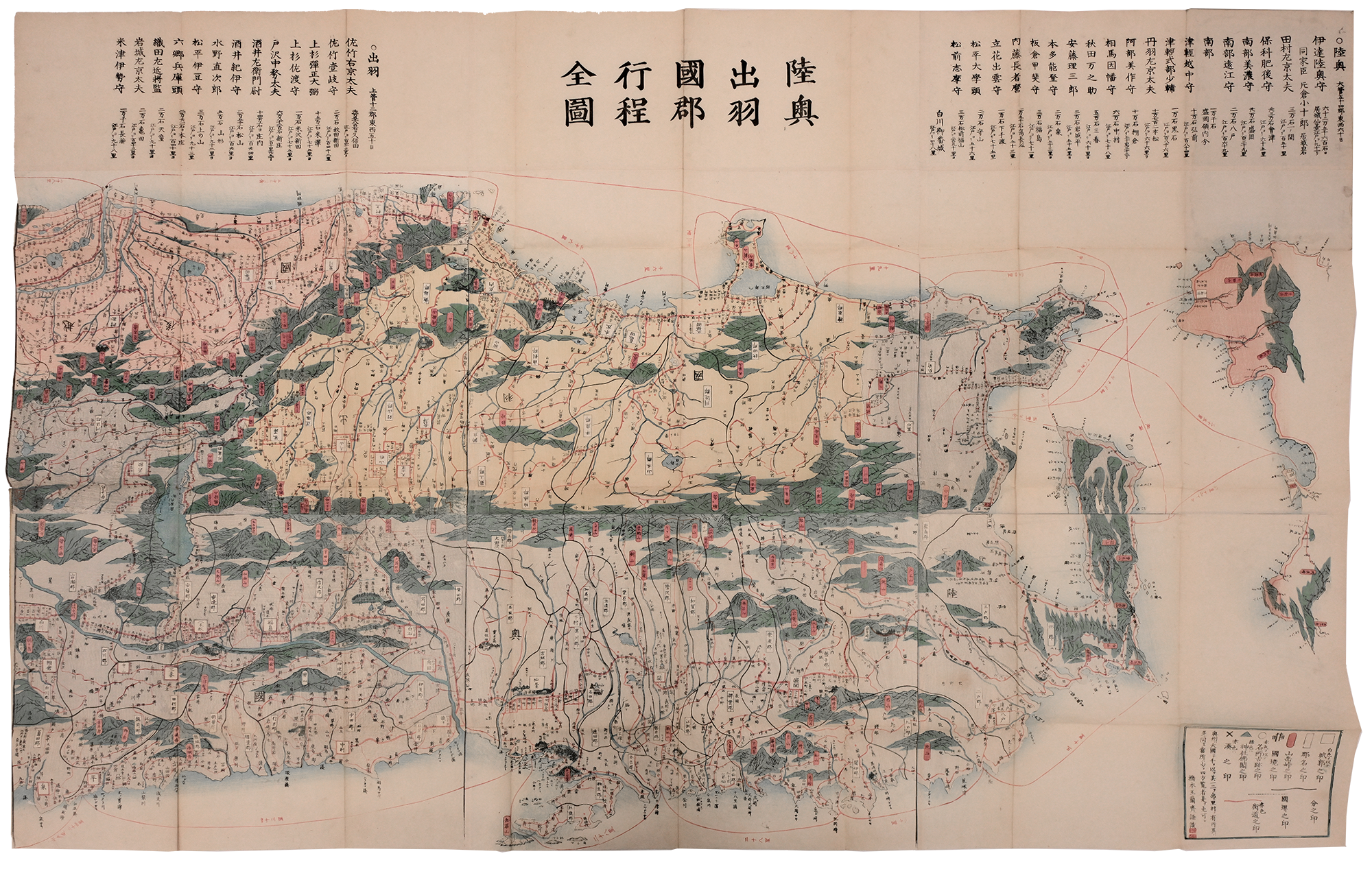
The Complete Map of Counties in Mutsu and Dewa (Mutsu Dewa kokugun kōtei zenzu 陸奥出羽国郡行程全図) by Hashimoto Gyokuransai 橋本玉蘭斎 (Utagawa Sadahide) (1807–c. 1878–1879) is undated, but believed to be c. 1868. Printed on paper in color, the map measures 91.44 cm × 144.78 cm. In it we see a detailed topographical view of the north of Honshu, presented at an angle rather than overhead, giving it an artistic flourish and additional details. The map was published the same year the new Meiji government was established. It shows major roads, post towns, and navigational routes.