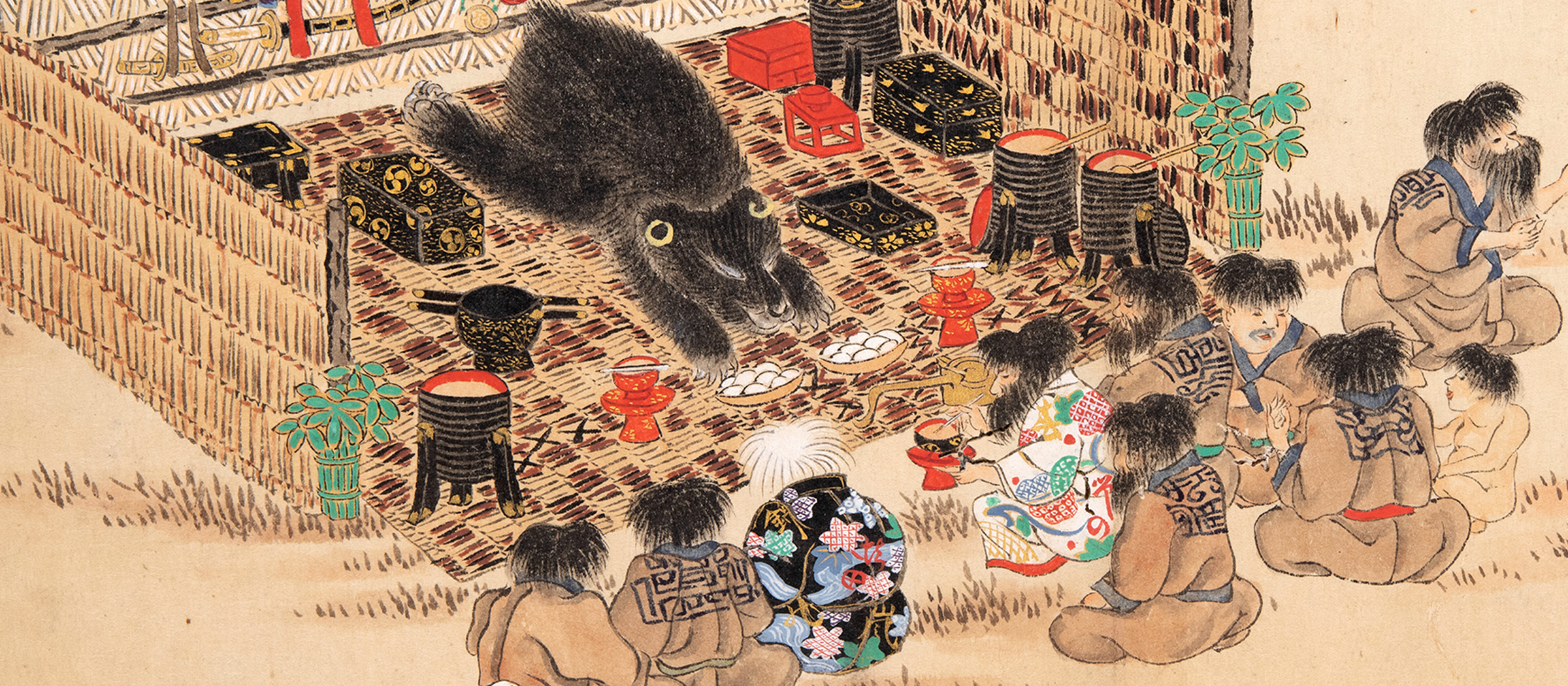
Complete Illustration of the Land of Ezo
Ezo no kuni zenzu 蝦夷国全図
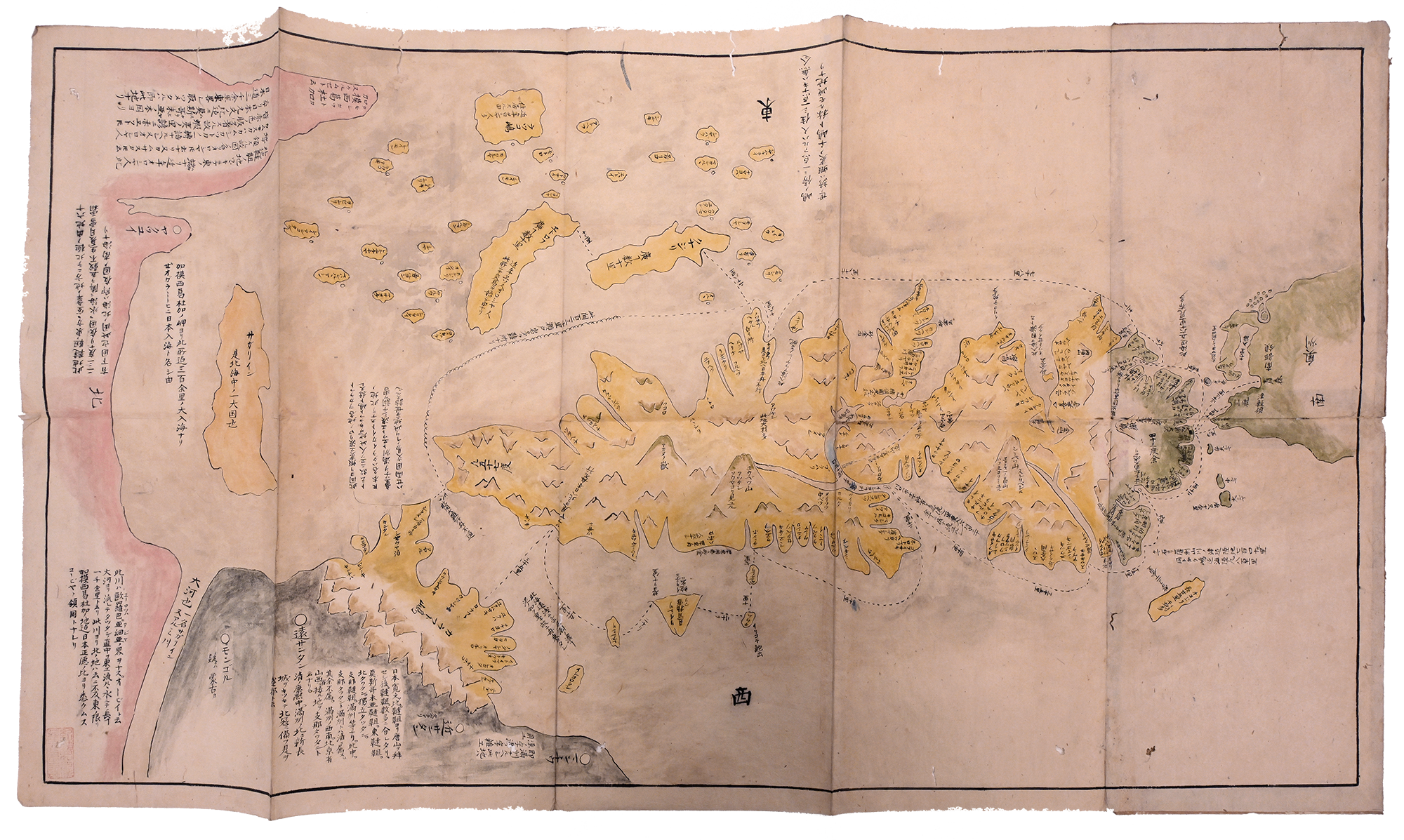
Complete Illustration of the Land of Ezo (Ezo no kuni zenzu 蝦夷国全図) is a copy of a map originally by Hayashi Shihei 林子平 (1738–1793), an early modern military strategist and cartographer. The original map was made in 1785, depicting the Ezo region, northern tip of Honshu, and parts of the Asian continent. The map measures 96 x 52.5cm and is handpainted with color on paper. The copyist is unknown.
Hayashi’s first map, A Complete Illustration of General Routes Map of the Three Lands (Sangoku tsūran yoshi rotei zenzu 三国通覧輿地路程全図), showed the three lands surrounding the Japanese archipelago (Ezo, the Ryukyus, and the Korean peninsula) along with various other nearby land masses. However, Hayashi Shihei was outspoken on his opinions about Tokugawa state policy, and his various publications earned him official censure and a ban on many of his works in the 1790s. Nevertheless, his works continued to be copied and circulated, including this map.1Ronald P. Toby, Engaging the Other: ‘Japan’ and Its Alter Egos, 1550–1850 (Boston: Brill, 2019), 55–63. We can find many similar versions in collections around the work that appear to be amateur in nature, such as the copy at the University of British Columbia.
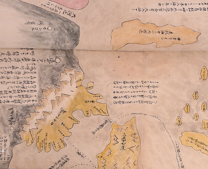
Of particular note in this map is the representation of Sakhalin as two geographic locations, an island identified as Sakhalin and a body of land connected to the mainland labeled as Karafuto.2Karafuto 樺太 was the Japanese name for Sakhalin Island. This mistake is likely due to the mistaken belief before Tokugawa expeditions of the mid 1780s that areas of Ezo (particularly Sakhalin) might be connected to the continent.3Kazutaka Unno, “Cartography in Japan,” in Cartography in the Traditional East and Southeast Asian Societies, vol. 2 of The History of Cartography, J.B. Harley and David Woodward, eds. (Chicago: University of Chicago Press, 1994), 445.