Detailed Provincial County Map of Hokkaidō
Hokkaidō kokugun meisai-zu 北海道国郡明細図
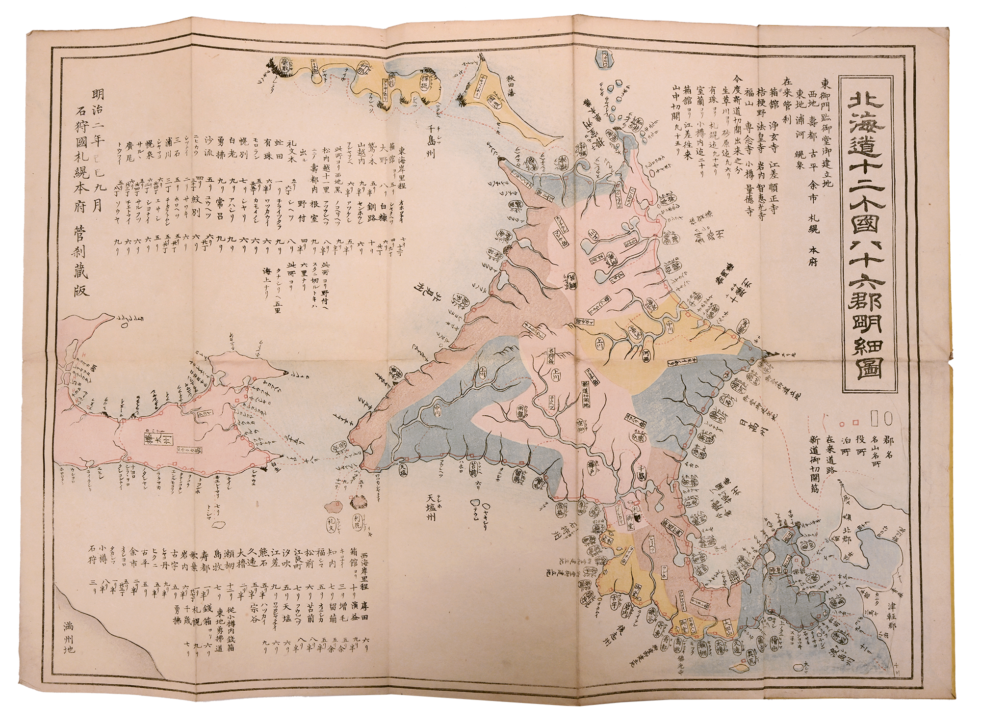
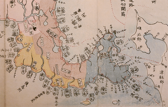
The Detailed Provincial County Map of Hokkaidō (Hokkaidō Kokugun Meisai-zu 北海道国郡明細図) was published in 1869, one year after the new Meiji government was established. It is printed in color on paper and measures 35.56 cm × 50.8 cm. In contrast to many earlier maps from the Edo period (such as the Map of the Three Lands Surrounding Japan (Dai-Nihon setsujō sangoku no zenzu 大日本接壤三國之全圖)), by this time Hokkaido had been surveyed and mapped repeatedly, providing a much more geographically accurate representation of the island. The publisher of the map is listed as “Ishikari no kuni Sapporo honbu 石狩国札幌本府 Kansatsu Zōkan 管刹蔵版.” Ishikari no kuni was a province (recently established at the time this map was created) covering a significant portion of Hokkaido. It was dissolved in 1882. Despite the extensive mapping of Hokkaido by this time, it is worth noting that the most detail information continued to be regarding the Matsumae area (Fig. 2).