Simplified Map of Three Provinces: Mutsu, Dewa, Echigo (Including Sado Island)
Ouuetsu sangoku ryakuzu fusado 奥羽越三国略図附佐渡
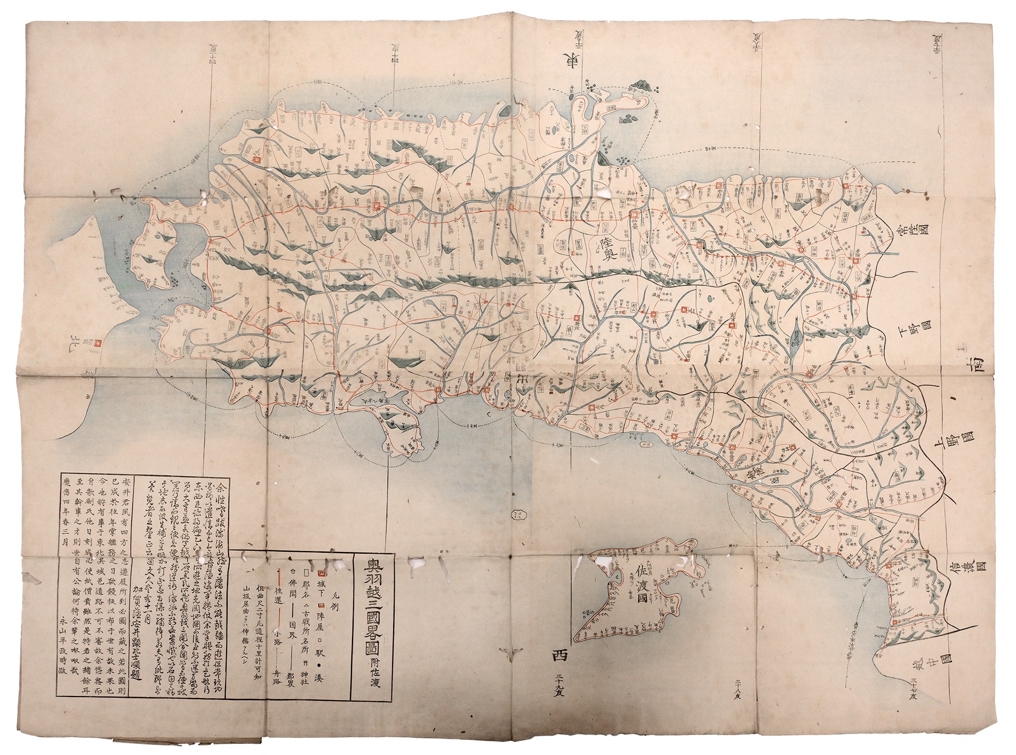
Like the Complete Map of Counties in Mutsu and Dewa (Mutsu Dewa kokugun kōtei zenzu 陸奥出羽国郡行程全図), the Simplified Map of Three Provinces: Mutsu, Dewa, Echigo (Including Sado Island) (Ouuetsu sangoku ryakuzu fusado 奥羽越三国略図附佐渡) depicts the northern areas of Honshu. It was created in Keiō 慶応 4 [1868], just as the new Meiji government was established. It is printed on paper in color and measures 97.16 cm × 71.76 cm. The map lists Yasui Kenbishi 安井顕比士 as its author and Nagayama Heisei 永山平政 as its editor. Some topographic features, such as mountains, are represented in a limited way, but the emphasis is on towns and travel routes.